Surveying and maps
Land measured and drawn to scale
- 1Knotted cord pegged as a right triangle
- 2Groma with its four plumb lines
- 3Ranging poles
- 4Surveyor's chain
- 5Plane table with sighting rule
- 6Theodolite
- 7Map to scale: baseline, triangles, contour lines
Surveying measures the lengths, angles and heights of a piece of land so that it can be marked out again or drawn at a fixed reduction on a sheet. Field plans on clay survive from about 2100 BCE, and the same craft later mapped whole countries from one measured baseline and a network of triangles.
What it is
Surveying is the measurement of land: its lengths, its angles and the rise and fall of the ground. With those figures a boundary lost in a flood can be set out again, a field’s area and tax worked out, and a road pegged before anyone digs.
A map is those figures drawn to scale. On the plan of a field, every horizontal distance shrinks by the same factor, so angles stay true and a ruler on the sheet gives distances on the ground. Over a whole country, the curve of the Earth adds some distortion. The plate gathers the tools of the trade, from the knotted cord to the theodolite.
How it works
Lengths. The first surveyors laid cords and rods of agreed length end to end, and paced when a rough figure would do. In 1620 the English mathematician Edmund Gunter devised a chain of 100 links, 66 feet long, so that ten square chains make one acre.
Right angles and straight lines. A loop of cord with twelve equal spaces, pegged as a triangle with sides of 3, 4 and 5, closes a right angle, because 3 × 3 + 4 × 4 = 5 × 5.
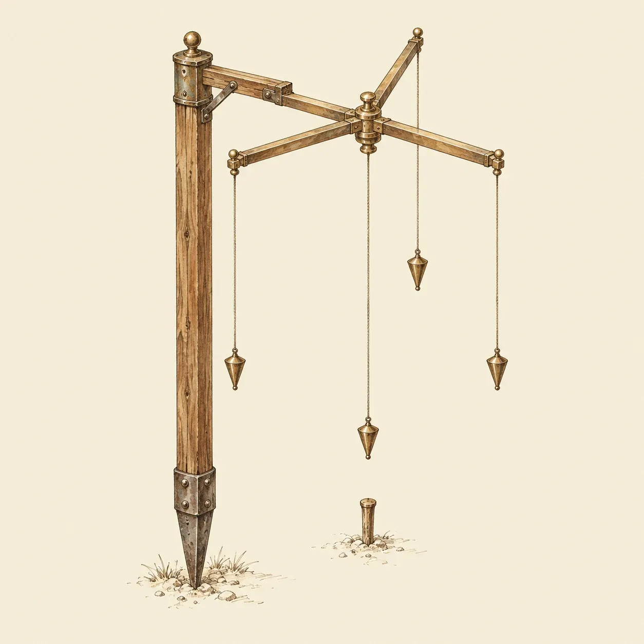 The groma: sighting past two opposite plumb lines gives a straight line, and the other pair gives the line square to it.
The Roman groma does the same job by eye. A cross of two arms turns at the end of a short bracket on top of a staff, which keeps the staff out of the sight lines, and a plumb line hangs from each arm end. The surveyor sights past two opposite lines while an assistant plants poles in line, then uses the other pair for the perpendicular. Wind swings the lines and spoils the sighting.
Heights. Water at rest is level, so a groove or a tube of water gives a horizontal line, and a plumb line gives the vertical. Height differences taken from stake to stake add up to the fall of a whole valley.
Triangulation. Long distances are slow to measure on the ground; angles are quick to take. Measure one baseline with great care, then from each end sight a distant point and note its angle to the base. One side and two angles fix a triangle, so the distance to the point can be calculated or drawn to scale. Each new side becomes the base of the next triangle, and a chain of them can cross a country from one measured line.
Angle instruments. The plane table needs no arithmetic: the surveyor sights each target along a ruler with two upright vanes and draws the ray on paper pinned to a level board. The board is then set up over the other end of the base and turned until the drawn base points back along the real one; the new rays cross the old ones at the points sought. The theodolite reads horizontal and vertical angles on graduated circles, through a telescope on later models.
On the sheet. A scale bar ties lengths on paper to lengths on the ground. A north mark orients the map. Contour lines join points of equal height: where they bunch, the slope is steep.
How to build it
You need cord, pegs, three or four poles, a 30 m tape, a sighting compass, a protractor, squared paper and 10 to 15 m of clear plastic tube.
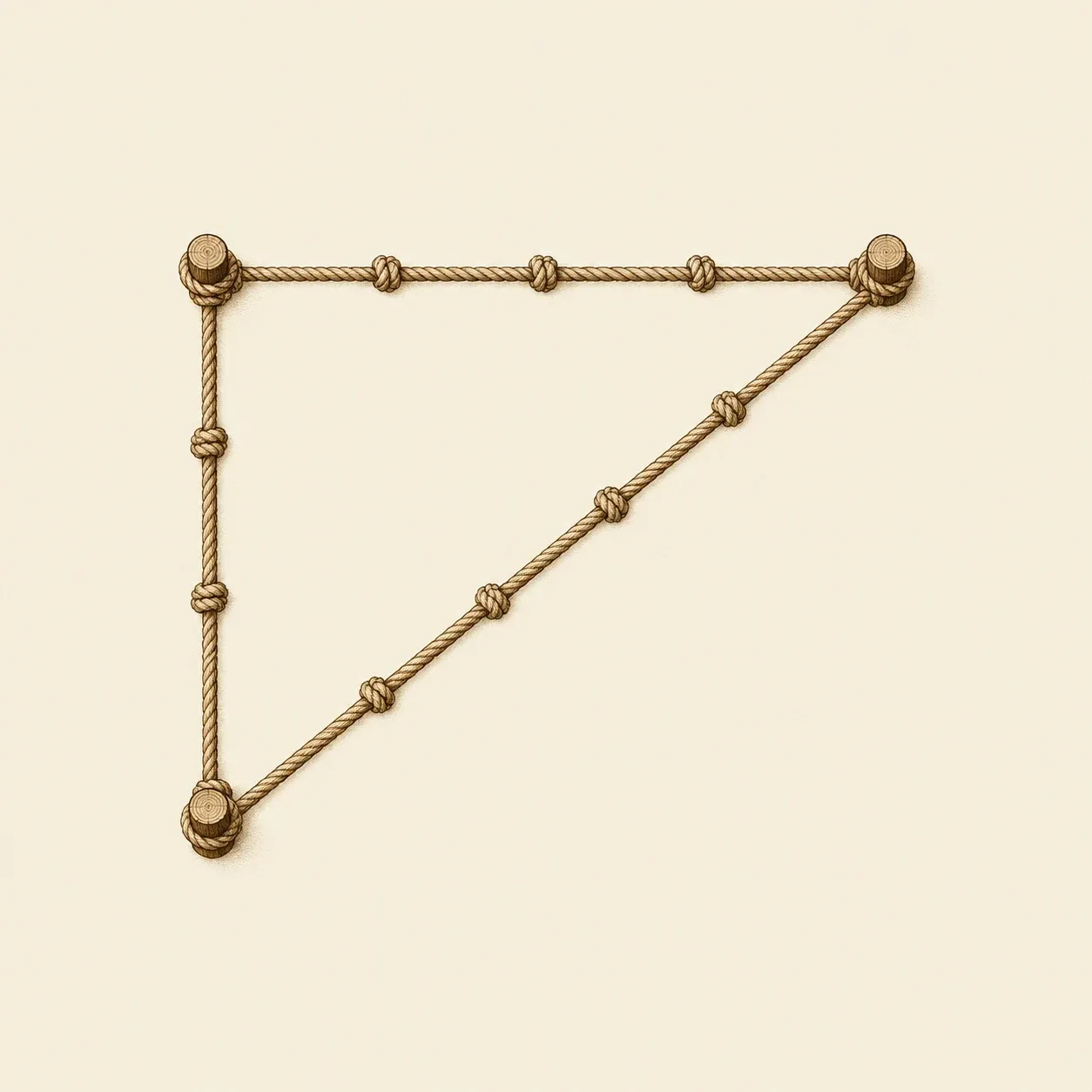 Three, four and five spaces of the same cord always close on a right angle.
Make a right-angle cord. Tie a cord into a loop that measures exactly 12 m when pulled taut, leaving extra cord for the knot. Stretch it and mark three corners so that the sides between them measure 3, 4 and 5 m: pegged at the marks, the loop closes on a right angle.
Build a groma or cross-staff. Nail two straight 60 cm laths across each other at their middles and square them with a carpenter’s square or a small 30-40-50 cm triangle. Hang a thread with a small weight from each end and mount the cross on a 25 cm arm fixed to the top of a pole, so the pole stays out of the sight lines. Level both arms before each sighting. A simpler cross-staff is a block on a stake with two saw cuts at right angles.
Use the sighting compass. Hold it level, away from cars and fences, sight the target and read the bearing. It gives magnetic north, which differs from true north by the local declination; keep to one north throughout.
Measure a baseline. On level, open ground with a clear view of every point you need, set two poles 30 to 50 m apart. Keep the tape taut and horizontal; on a slope, measure in short level steps and drop a plumb line at the end of each. Tape once in each direction and measure again if the results differ by more than a few centimetres.
Triangulate a field or a pond. From each end of the base, take the angle between the base and every corner or bend of the shore. Keep the triangles well shaped: an angle under about 30° makes small errors large.
Draw it to scale. At 1:500, one centimetre stands for five metres. Draw the base, lay off each angle with the protractor from both ends and mark where the rays cross. Add a north arrow and a scale bar, then tape one distance you did not use and compare it with the map.
Find heights with a water tube. Fill the tube without air bubbles. Hold the ends against two stakes, let the water settle and mark its level on both. The marks are level with each other, so comparing their heights above the ground gives the rise between the stakes. Points of equal height, joined on the map, make a contour line.
Safety. Never survey on a road or across traffic. Ask permission before entering private land. Keep back from riverbanks, steep pond edges and quarry rims, and do not wade to place a pole. Never sight the Sun through a compass, a sight or any lens: it can damage your eyes in an instant. Carry pointed poles and pegs tip down.
History and evolution
Among the oldest surviving field plans are clay tablets from Umma in southern Iraq, from about 2100–2000 BCE. They sketch a field, note the lengths of its sides and work out its area, without drawing it to scale.
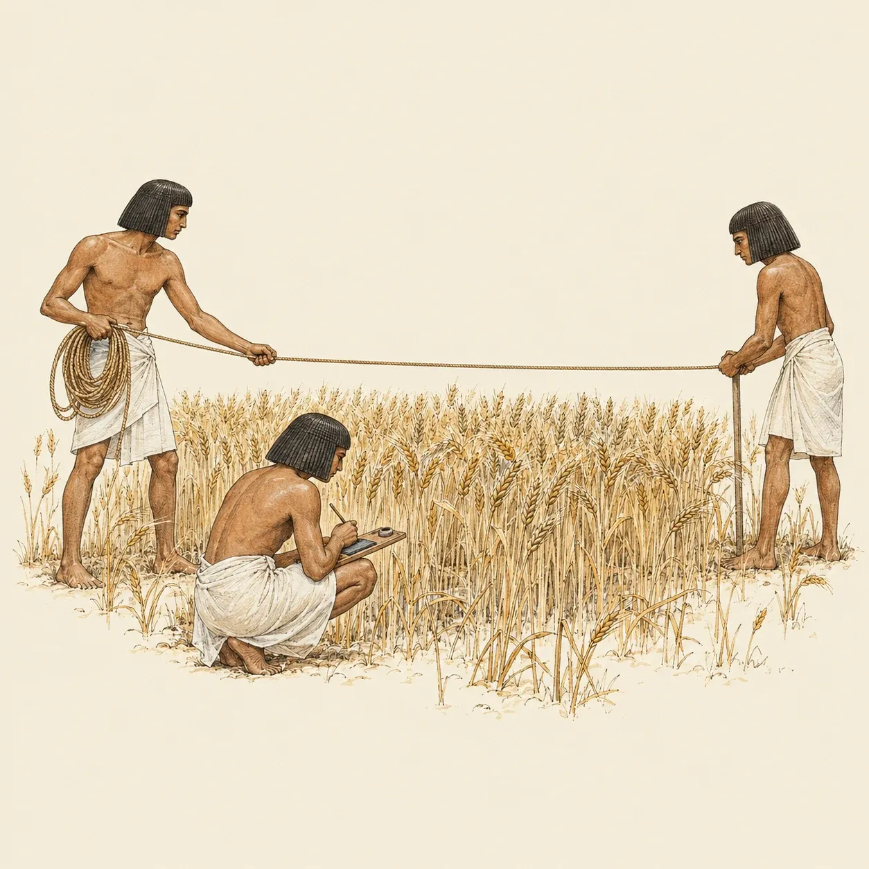 Egyptian field officials measured standing crops with a cord before the harvest was taxed.
In Egypt, New Kingdom tomb paintings show officials measuring grain fields with a cord, as in the tomb of Menna, overseer of fields under Amenhotep III in the fourteenth century BCE. Herodotus wrote that when the Nile carried away part of a plot, officials measured the loss so that the tax could be cut. The 3-4-5 cord often credited to Egyptian rope-stretchers appears in no Egyptian text; the historian Moritz Cantor suggested it around 1880. The Indian Śulbasūtras, altar-building manuals from about 800 BCE onwards, do lay out figures with stretched cords.
Roman surveyors divided conquered land into square plots and laid out camps and towns. The metal parts of a groma were excavated at Pompeii in 1912, in the workshop of a surveyor named Verus.
In 1533 Gemma Frisius of Leuven proposed locating places by angles from a base. From 1615 Willebrord Snellius, at Leiden, linked Alkmaar to Bergen op Zoom, about 130 km apart, by triangles sighted from church towers, and published the work in 1617. The theodolite appears in Pantometria, a book by Leonard Digges that his son Thomas completed and published in 1571. In France, the triangulation of the Cassini family became the frame of the first complete map of the kingdom: 180 sheets at 1:86,400, published from 1756 to 1815.
Aerial photographs, distances measured by light and radio waves, and now satellite receivers that fix a point to a few centimetres have replaced most chains and poles.